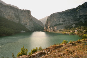
阿尔巴尼亚主要河流、湖泊(英)
In the North-Western part of the country, there is the Shkodra Lake, which is the largest in the Balkan Peninsula. It is 368 square kilometers, out of which 149 square kilometers are within the borders of our country. Its depth is 10-12 m. It has a tectonic - karsts origin. In the North-Eastern part, there is the Fierza lake named after the Hydro-Power Plant. In the South-Eastern part, there is the Ohrid lake of a karsts origin and a surface of 367 square kilometers. A bit southward there are two other lakes of tectonic origin: Bigger and smaller Perspa lakes with 285 and 44 square kilometers respectively. Other small lakes have dotted Albania as well. In the western part of the country, in Dumrea area, there are several karsts lakes 80 m above sea level. Whereas in Lura area 1600 m above sea level, there are several glacial lakes, which are located in groups, thus providing a magnificent view and leaving deep impressions in you.
The main rivers permeating the territory of our country are: Drini (285 km), Semani (281 km), Vjosa (272 km), Shkumbini (182 km), Mat (115 km), Buna (44 km), Ishmi and Erzen.
List of rivers of Albania
From Wikipedia, the free encyclopedia
- Berisha River
- Bistrica River
- Bushtrica River
- Buna River
- Cemi River
- Drin River
- Black Drin (Drini i Zi)
- Devolli River
- Drino River
- Dunaveci River
- Fani River
- Fani i Madh River
- Fani i Vogël River
- Erzeni River
- Gomsiqja River
- Gostima River
- Gjadri River
- Gjanica River
- Gjolja River
- Ishmi River
- Kalasa River
- Kiri River
- Lana River
- Lesniqja River
- Mati River
- Nikaj River
- Osumi River
- Qarishta River
- Rapuni River
- Semani River
- Shkumbini River
- Shushica River
- Vjosa River
- Pavllo River
- White Drin (Drini i Bardhë)
- Tërkuza River
- Tirana River
- Valbona River
- Zeza River


